Dit zijn de afstanden die er per dag gefietst zijn. Dag 4 was de rustdag.Dag 5 en 6 waren de dagen dat we rond hebben gereden in de Veluwe zonder bagage.

BramTeunissen.com
Italy - Day 7 : Tuscany
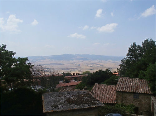
When we woke up, the man next to us had already left. After five days of cycling, we were more than a day ahead of the minimal distance required to catch the bus. Instead of cycling directly from Pisa to Florence, we would make a loop through Tuscany and spend half a day in Florence. At this campsite, we again needed to pay less than the standard fee. They had charged us for two people and only one tent. We didn't mind because this campsite was ridiculously expensive. Pisa lies on a large plain cut through by a river. The only road running in our desired direction was a highway, so we were forced to take a ten km-long detour. The first 40 km went fast. Cycling was a lot easier now that the roads were flat. After a quick stop at a supermarket, we continued to Volterra. The landscape became increasingly desolate and mountainous.


View over Tuscany
We finally arrived in an area that looked like how I had imagined Italy: dry, hot, and many plains filled with cypresses and a few houses. It looked like a pasta commercial.
In a Tuscan village
Volterra is a relatively large town on top of a mountain. The climb wasn't very steep, but it was ridiculously hot today. During the climb, we met a group of cyclists from Switzerland. They were between 40 and 60 years old and cycled about as fast as us. They were cycling from Zurich to Rome. One man told Bram, 'Yeah, we are cycling 120 km a day, but we don't carry luggage'. Bram thought it was better not to reply to that. We talked with them for a while until they took a break. The last part of the climb was pretty steep. In a supermarket, we bought way too much food and cycled to the old center to eat. An old lady was hanging out of her window, spying on us and everything else.


View over Volterra
During the descent, we were completely blow-dried. We passed through a few villages that were all built on hills. It was so hot that we each drank 7 liters of water today. Near the end of the day, we were out of the water and searching for a supermarket. There was one in a nearby village, but it was closed for another hour. We took a detour to find another town. We arrived at a geo-energy plant with some houses next to it. The entire mountain was covered in aluminum tubing. Luckily we found some water (and a closed supermarket). The following road climbed up through a forest, sometimes at a 10% incline. At the bottom of the descent was a city that would likely have a supermarket.
Upon arrival, we asked a lady if there was one, but she didn't understand my English. I knew just enough Italian to say 'supermercato,' to which she pointed downhill. We bought a bunch, including a kilo of cherries. In a park, we sat down to eat in the shade. I was super hungry, so I ate three-quarters of the cherries. I could feel I was getting in shape and more used to the heat. Therefore I had less difficulty keeping up with Bram.
Near the end of the day, the landscape got less dry, and there were more forests. We could cycle to Florence in three ways, a short, medium, or long road. We chose the medium one, which was about 100 km. First, we still needed to climb a lot, though. After the descent, we followed a river for about 10 km. By then, it was already nine, and we had arrived at a village on top of a mountain called Roccatederighi.


View over Roccatederighi
All stores were closed. After the village, we sought a place to camp, which was difficult because there were still many houses. Eventually, we found a steep path leading down the mountain along some meadows.


Today's camping spot
Bram noticed a firefly when it started to get dark. A while later, there were at least 30. I had pitched my tent without the outer tent so it would be less warm. When I woke up in the middle of the night, the flies were still there.

The route of day 7

Height profile of day 7. The flag indicates Volterra. It was still hilly afterward.
Around 110 km, the GPS lost signal for a while.
Distance cycled : 165 km.